Showing posts with label Cader Idris. Show all posts

Thursday, 4 June 2015

Cyfaredd 12: Castell Henllys

Haia Pawb

One of the reasons I travelled to Britain in 2013 was to conduct research for my dark ages novel. I had a few sites in mind, which I then visited (or not, as explained in my post about Dinas Emrys). However, after my return to Australia I discovered more places I would like to visit, if I ever had the chance to come back.

The residency at Stiwdio Maelor came when I least expected such an opportunity and in the last week of my time there I picked up a hire car for the research phase of my trip. My posts about Cader Idris and Dinas Emrys describe two early research outings, but on the actual day I picked up the car I decided to visit Castell Henllys ('castle of the old court'), a reconstructed Iron Age village built on the site of an ancient village.

For my novel I plan to set a number of scenes in roundhouses, situated in various parts of the island, so I welcomed the chance to visit roundhouses built in the traditional way. Castell Henllys has four, plus a granary that is built off the ground, unlike the others. All of them have been reconstructed on their original foundations, with the upright poles that support the roof of each roundhouse having been placed into the original post holes. The size of each roundhouse has been gauged from the remains of drainage ditches.

One thing I noticed was the different levels of finish between what was termed the Chieftain’s Hut and the other roundhouses. This difference in finish was evident both in the interior, with the varied quality of paintings and lime wash around the wattle and daub walls, and the exterior, with the thatching around the doorway cut higher on the Chieftain's Hut so that those entering didn’t have to bend.

Below are videos and photos of aspects of the village I may use in the novel:
Video of the roundhouses and surroundings.
The 'Chieftain's Hut'.
Note the high thatching above the entrance.
Interior of the 'Chieftain's Hut'.
Typical Iron Age loom. 
Polished bronze cauldron. Sunlight coming through the doorway
(which is in the east) would make the cauldron glow like gold
to impress visitors to the 'Chieftain's Hut'.
Range of reproduction swords and scabbard.
Hilt of reproduction ceremonial sword.
Saddle quern, used to grind corn*. Bone analysis shows females
suffering from arthritis in hands, knees and back, possibly from
long hours spent using such querns in a bent over position.
Rotary quern, a more efficient way
of grinding corn.
Raised hearth in the 'Cook House'.
Typical wooden bowls.
Video of interior of a roundhouse used for meetings.
Up to 80 warriors could assemble in here. 
Chieftain's Chair in the Meeting Hut.
Forge in the smithy's roundhouse.
Note the double hand bellows on the right.
Small iron anvil embedded in a log.
Wooden container of charcoal used for the forge.
(My foot being there is not a mistake, but is used for scale.)

The granary. Being off the ground allows
air to circulate and keep grain dry.

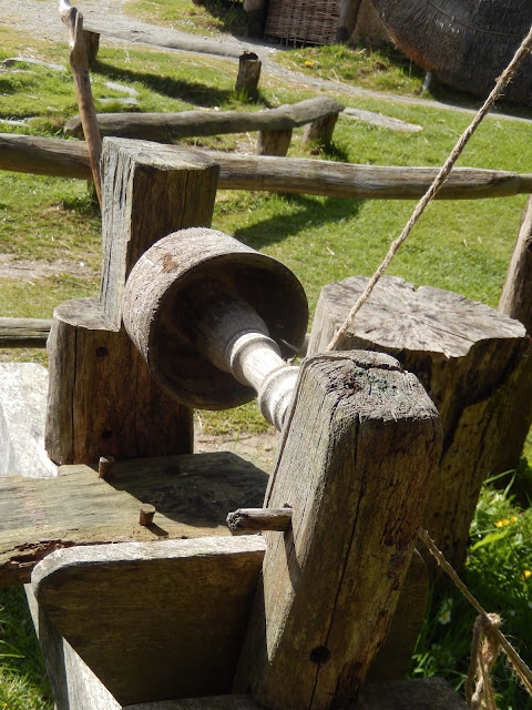
Wood lathe. 
Bread oven.
Interior of another round housing, showing central hearth,
loom and box beds against the far wall. Note the iron cauldron,
obviously not used for showing off status.
Although I have done and continue to do much book research, such visits produce practical insights into lifestyle and setting that I am sure will provide authentic 'telling details' for my novel. 

For those following my jackdaws 'saga', here's another instalment:
'Is this seat taken?'
By the way, my friend Ali Ni Dhorchaidhe, whom I met at the 2009 W B Yeats Summer School and who has studied Irish and Scots Gaelic, tells me the Irish Gaelic for jackdaw is cág, pronounced ‘cawg’, the word being like the sound they make.

Till next time.

Cofion cynnes (Warm wishes)
Earl

PS. Corn in this case means wheat and other cereal crops, not maize, which is called corn by Americans and Canadians and wasn't introduced into Britain till after Columbus returned from the Americas.

Tuesday, 19 May 2015

Cyfaredd 10: Climbing Dinas Emrys

Haia Pawb

As I indicated in a previous post, in 2013 I climbed what I thought was Dinas Emrys. For those of you who don't know, Dinas Emrys is a mountaintop stronghold made famous in the Historia Brittonum and Geoffrey of Monmouth's Historia Regum Britanniae as the place where Merlin (or Ambrosius Aurelianus) as a child confounded King Vortigern's advisors and uncovered the prophecy of the Red and White Dragons. Being quite interested in Merlin mythology, I decided to experience the place myself.
Dinas Emrys (photo from here)
However, as my post on Cader Idris indicates, I have a tendency to go off on my own and not (re)consult maps and the like. After I climbed the mountain and found what I thought was the pool under which the dragons had been 'discovered', I didn't know till I arrived back in Australia and started looking at other people's accounts that I hadn't climbed Dinas Emrys at all, but a mountain further down the road. Somehow, I had missed the real location and found a mountain with a similar profile but which was much bigger, hence the aching limbs and tiredness that prevented me from climbing Cader Idris the next day.
Dinas Emrys (diagram from here)
This time around, I was determined to climb the right mountain. I followed travel instructions I found online, arrived at the Craflwyn car park (one mile north of Beddgelert) and studied the map that detailed the various paths.
Map board at Craflwyn car park
Of course, as you can probably guess by now, my walk didn't go exactly to plan. The colours used on the map weren't the same as the colours used on the trail markers and I ended up going on a long hike before reaching the track that took me up Dinas Emrys. For those of you aware of The Hero's Journey, based on Joseph Campbell's The Hero with a Thousand Faces, you'll understand how I was starting to feel as if the landscape was acting as some sort of Threshold Guardian and testing if I was worthy enough to reach Merlin's mythological site.
The path up the ridge to Dinas Emrys
So, after two attempts and a long detour I arrived at the summit of Dinas Emrys, with its ramparts and remains of walls and foundations. The views from there were amazing, which is probably why it was chosen (apparently by Llewelyn the Last) as a castle stronghold to guard the mountain pass of Snowdon.
Remains of a tower
View of Llyn Dinas from the top of Dinas Emrys
View of surrounding mountains
I knew I had found the right mountain because finally I was able to see the famous pool and its platform, though apparently the platform is dated later than the accepted periods for Vortigern and Ambrosius.
Pool and platform
Fortifications
More fortifications and building remains
With the masonry, the pool, the trees budding with Spring growth, the green moss and dormant heather, the hidden birds chatting amongst themselves about the quiet intruder, and the wind tousling leaves and rippling across the open areas, the place felt both mysterious and familiar.


Brief video of trees, birds and wind
A touch of magic
After exploring the summit, I found a small cave that kept the wind out and ate my lunch, after which I closed my eyes to concentrate on any mythic whispers that might come out of the earth. Maybe an idea for a scene in my book or useful images. White-knuckle mountains. The new leaf of a hazel tree feeling like the skin of a baby. Rivers like sweat from the brow of Gofannon, the Celtic God of metalworking.
The cave
I spent almost two hours on the summit and was only been interrupted once, by a man and a woman asking for directions. Luckily for me, they showed no interest in the place itself, no awareness of its mythological importance. But after some time in the cave I felt the need to move on. Just in time, too, for a group of walkers, who seemed intent on exploration, came up the ridge as I started down. After the testing by the Threshold Guardian, I had been blessed with quiet and inspiration and so could continue my own explorations elsewhere.
A waterfall I passed on the way back
When I returned to my car, I continued along the A498 to find the mountain I had climbed in 2013.  It was about another mile down the road. I still don't know how I missed Dinas Emrys the first time. That Threshold Guardian, I suppose.
The mountain I climbed in 2013
Dinas Emrys, in 2015 (less than half the height)
I hope you all manage to move further along your own hero/heroine journeys.

Till next time.

Pob Hwyl
Earl

Sunday, 17 May 2015

Cyfaredd 8: Climbing Cader Idris

Haia Pawb (Hi Everyone)

When I stayed in Dolgellau in 2013, I planned to climb Cader Idris, that mountain on which if you spend the night you come down either mad or a poet. Unfortunately, the day before this planned ascent I climbed what I thought was Dinas Emrys, which proved a tougher task than expected (more about this in another post) and was so stiff and sore I couldn’t contemplate attempting Cader Idris. This trip, however, I decided to tackle the famous mountain first.


Cader Idris and the various paths
The route I took is called the Minffordd Path, which is steep in places (two climbs of over 300 metres), but also shorter (4.4 kilometres) than the easier track (Pony Path, 5.0 kilometres). After dutifully following signs and huffing my way up the first steep section, I came to where the track ended at a t-intersection. The way to the left seemed to take me away from the mountain, so I took the right one. I’d been walking in light drizzle to this point, but I felt sure the weather would clear soon enough. I was wrong on both counts.

It turned out the right-hand path lead to the lake in the middle of the ‘chair’, Llyn Cau, and not up the mountain. Of course, if I had consulted my map I would have realized this, but I had looked at the instructions at the start of my climb and thought I knew what I was doing. Although the choice was wrong, I was glad I came upon the lake. No sound but occasional bird call-signs. A slight breeze that wove intricate patterns on the surface of the lake. Mountains towering above me. A seabird that used the thermal above the lake to soar upwards. No other walkers. A great spot to sit for a while and contemplate whatever thoughts came up, or no thoughts.

Llyn Cau, with the back of the 'chair', Craig Cau, in the background.
Then came the time to continue my ascent. A path wound around the lake, which I assumed would eventually lead upwards. Wrong again. It ended near a steep section of scree-fall. Undeterred by the increasing rain and the descending mist--I had seen such sights around the mountain from Dolgellau and watched them vanish after a while--I started upwards. Step by step. One or two slides, but no concern. Heavy going. Use embedded rocks and knots of grass to pull myself up. Clamber. Watch the mist clear a little, the rain drop. Clamber. Stop for breath. Climb in sets of steps, each set reducing in number. Stop for breath. Keep going till the top is in sight. Dig in to scree and cracks in the rocks. Keep going. Get there.

View of Llyn Cau after my climb up the scree.
Where I emerged, happy to find the right track!
I gained the Minffordd Path and continued towards the top of Cader Idris, which is called Penygadair. The mist had thickened, but not enough that I couldn't see the cairns that had been set up either side of the track for just this eventuality. The temperature was so cold, snow still gathered in nooks and crannies:


Eventually, Penygadair came in sight:

The monument at the top of Cader Idris.
I clambered over the rocks and stood on the summit (893 metres). The mist was so thick, I couldn't see much at all. However, the sense of accomplishment, of doing the climb the hard way and succeeding, compensated for the lack of views and the tingling feeling in my fingers from the cold that penetrated my thick gloves.

Video from Penygadair when I first arrived.
After finding a cleft that protected me from the buffeting cold wind, I ate my lunch, listened to the wind whistle around the mountain and watched the mist open and tantalise with glimpses of brown, green and blue, then close. Soon it cleared completely, and the views, of distant mountains and of the coast, were stunning.

Video after the mist cleared.
Other walkers started arriving at the summit, so I decided to head back down. I took the track that continued around the chair and after a a couple of tumbles on wet stones, I reached the car park.

The plateau on the other side of Penygadair,
part of the track back down the mountain.
The whole trip took seven hours. Strangely, I wasn't exhausted but exhilarated by the experience--the physical test of the climb itself and the views of the land I have come to love.

View on the way down: Llyn Cau, with Craig Cau behind it,
and Penygadair at the top right. The long black line stretching from the lake
to the ridge on the right of Craig Cau is the scree-fall I climbed.
Of course, the climb also had a lesson for me. It showed me that sometimes I turn relatively easy tasks into difficult ones, mainly because I don't re-check my plans/facts when I should. Maybe I was lucky that the weather didn't turn worse, though if it had I would have turned back. I had faith that the rain and mist would clear, because of previous (albeit limited) experience of the mountain, and it did. Next climb, I'll be better at my planning and the execution of my plans. Stay tuned.

And to continue my jackdaw fascination, this is a photo of one taken from my room when I arrived in Moffat, Scotland:
'Made it, Ma! Top of the world!' (James Cagney, White Heat)
I hope things are going well for you and you're double-checking plans when you should :)

Until next time.

Pob Hwyl

Earl